Saturday 28 January
This morning we were off to do a part of the Central Otago Rail Trail, as the weather seemed to hold promise for the day. After sorting out what we needed, we left our parking spot at Oturehua and headed for Auripo which is where Bernice dropped off Roy so he could start his walk to Lauder. Bernice meanwhile drove through to Omakau to pick up a bike and start her journey biking from Omakau through Lauder to meet up with Roy somewhere along the track.
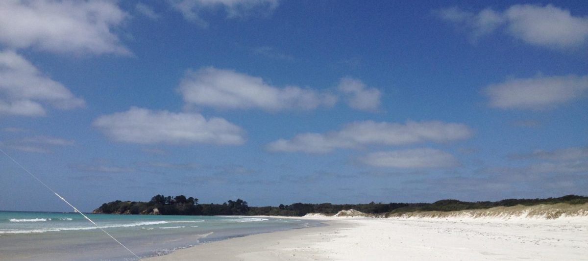
By the time we were both underway, a bit of a strong breeze had developed which made for interesting cloud formations, as well as sometimes difficult biking/walking conditions.
So on with the intrepid journey, by foot through the hinterland to cross the Ruggedy Range from the Ida Valley to the Manuherikia Valley through the Poolburn Gorge. This appeared to be an interesting section of the Rail Trail of about 10.5km. (and downhill)
First off to a good start from the site of the original Auripo Station

Interesting views from the Rail Trail down onto the plains of the Ida Valley including this one of a cut field of grass ready for baling.

Of equal interest were the cloud formed as a result of the wind blowing over the ranges at close to a right angle to the ridge direction setting up these waves of cloud.

Facilities along the way were provided by DOC up to their usual standard of cleanliness and lack of untoward odour.

Here we see contention from two wave fronts of different ridges

First real point of interest on the trail itself was the Poolburn Gorge Viaduct. It took three years to build and is 37 metres high and 109 metres long, the highest and fourth longest bridge/viaduct on the Rail Trail.

The viaduct is about three kilometres from the start point and is very soon, probably after 500 metres, followed by the first of two tunnels. The entrance to which is in a deep cutting.

This tunnel is curved so that as one enters their is no “light at the end of the tunnel” just an inky darkness. The first 50 or so metres of this tunnel are lined but from there until the middle section there is bare rock.

The middle section is again brick lined as is the far end of the tunnel.

A further kilometre into the trail and the second tunnel is found. This at 220 metres, is longer than the first but is a straight tunnel. Again it is lined for the first part and again at the far end.

However at the far end there is evidence of seepage not seen at all in the first tunnel.

Finally coming out of the tunnel one is approaching the end of the gorge and looking toward the Manuherikia Valley

The cloud forms here are again spectacular with all sorts of shapes and clouds in different layers.

Along the Trail there are a number of ganger huts erected to provide shelter and resting places for gangers working on the original line. This one at Poolburn even had a fireplace.

At last the Manuherikia Valley, the green line right across the mid ground is the course of the Manuherikia River.

And again on this side the cloud formations were very interesting.

Next came the Manuherikia Bridge, 110 metres long and 14 metres high it is the only curved bridge on the Rail Trail.

Finally the last bridge is a small wooden one over the Lauder Creek.

An unusual warning sign.

And a usual companion appears on the horizon

Finally the end of the section at Lauder Station

Then a misjudgement was made to continue the walk toward Omakau. An additional seven kilometres. Just a couple too far.
But the cloud formations were well worth the walk but not necessarily the accompanying sore feet!!


The over pass of Muddy Creek Road

And more sky…


And that was the end of the day for me, other than a pick up by the boss and a drive back to Hayes Engineering in Oturehua.
And from her? Well, I got on my bike and pedalled…..and pedalled. It took me just on an hour to reach Lauder from Omakau, and then continued on until I met up with ‘he who must…’. Of course I did not have a camera with me so you will have to take my word for it that the scenery was stunning, the sun shining, the wind blowing…and to prove that the wind does make a difference, it took me just 35 minutes for the return journey from Lauder to Omakau. Oh, it is a little downhill as well. Back to Omakau, return the bike and gear, pick up the car and back down the road to pick up the foot-sore Roy. The speedo on the bike told me I had biked 24.3kms, not bad for a very unfit moi! And the lasting effects? A very, very, sore bum!
Sunday 29th January
Off today, first stop was Omakau and the very nice Recreation Grounds and the necessary dump station. Then off over to Alexandra (again!), we are parked up here at the very nice POP at Molyneux Park, where today we have spent the day catching up with things such as blog/internet, grocery shopping, and generally relaxing and resting the sore bits!


